From the JohnGaltFLA perspective it would appear that Sir Ian is getting his shit together in a rapid way which means life in this region will be wet, sucking, and windy. Sort of like being an intern during the Clinton administration.
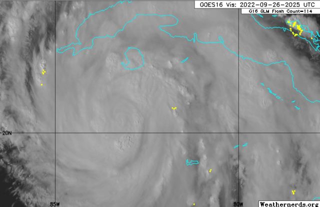
Here is the latest map:

I am far enough inland to not worry about the storm surge but some local estimates of rain between 10-25″ between Tuesday through Thursday makes me realize that living on a golf course near a retention pond may not have been the smartest move of my life.
Regardless, I expect to go black on the internet when the power and cable go out. So other than my Telegram channel where I will offer snarky commentary and keen insights on what it is like to babysit two moms, two old cats, and a wife who will shoot me when I decide taking my chances in the swimming pool during the peak of the storm might be more fun.
I will be back later to comment on the markets as the world is falling apart, wars everywhere, and Grandpa Applesauce Chin thinking he’s the greatest thing since JFK.
In other words, not only am I screwed, everyone else is also.
27.09.22 0500 EDT UPDATE:
This storm is rapidly intensifying. I have to go help a friend put up storm shutters this morning as it would appear we’re going to get hit by a Cat 3 possibly a Cat 4. Please understand I’m not being rude but odds are tomorrow I lose internet and power by 8 p.m. This one picture from the NWS Key West radar station says it all: